Features
Everything Worldkiln does, and what is coming
Each part of the editor, from the first seed to the finished map. Items marked In progress or Planned are on the roadmap and not in the editor yet.
World generation
Land, climate and water worked out together, so every part of the map has a reason to be where it is.
Generated land
AvailableContinents and islands with ridges, erosion and coasts, from a seed you can share or roll again.
Grid sizes
AvailableFrom a 256 grid for quick tries to 4096 for detailed worlds. 512, the default, builds in about two seconds.
Map shapes
AvailableSquare, landscape, portrait and widescreen worlds.
Climate
AvailableLatitude, temperature, rainfall, rain shadows behind mountains and polar ice set the biomes.
Rivers, lakes and seas
AvailableRiver density and windiness, lake fullness and size, and the sea level.
Live changes
AvailableClimate and water settings update as you drag; land settings rebuild the world.
Builds in the background
AvailableLarge worlds build without freezing the page, with progress and a cancel button.
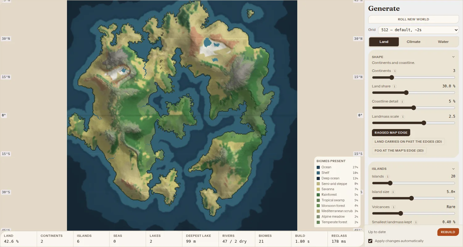
Shaping by hand
Generated land is a start. Brushes let you put the mountains and coasts where your story needs them.
Sculpt
AvailableRaise, Lower, Bluff, Shoreline erode and Smooth, in 2D and in 3D.
Paint biome
AvailablePaint any biome onto the land; the eraser undoes sculpting and painting.
Brush feel
AvailableSize, strength, round, irregular, speckled or block edges, and pen pressure for size or flow.
Undo and versions
AvailableUndo and redo, edits kept with the world, and named versions you can restore.
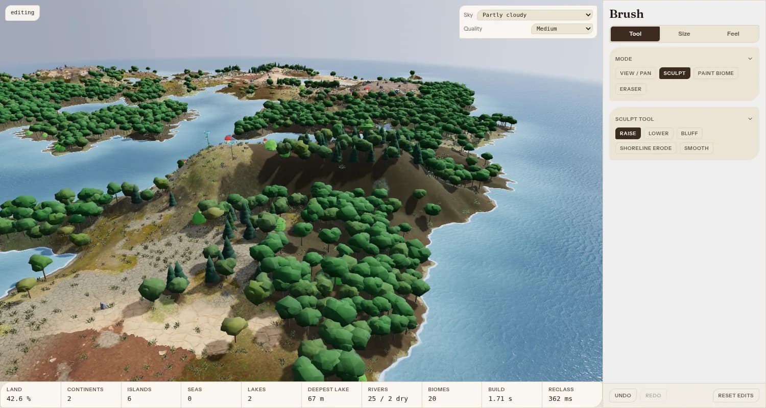
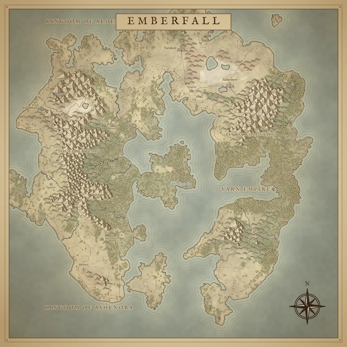
Three ways to see it
The same world as a working map, a 3D landscape and an illustrated map.
2D map
AvailableColour by biome, elevation, height, rainfall, temperature or continentality, with contours, latitude lines and wind arrows.
3D view
AvailableForests, snow lines, rivers, towns and fog at the horizon. Orbit, pan with WASD and choose the sky and quality.
Map view
AvailableAn illustrated map drawn by code in a Parchment or Painted style, with mountains, forests, borders, roads, names and a compass.
PNG download
AvailableDownload the Map view at about 2000 px, or 3600 px in high quality.
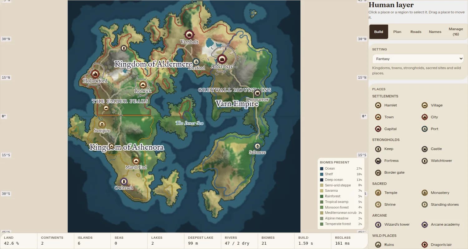
Kingdoms, settlements and roads
A human layer over the land: who lives where, who rules what and how people travel.
Settlements and sites
AvailableHamlets to capitals, ports, keeps, castles, fortresses, temples, wizard towers, ruins and lairs, each with its own symbol.
Kingdoms and regions
AvailablePaint regions with a brush or lasso; their borders show as coloured lines and their names across the land.
Roads
AvailableRoads between settlements made for you, or drawn by hand, with bridges over rivers and ferries across water.
Land names
AvailableName mountain ranges, forests and bays by drawing along them.
Fog of war
AvailableCover the map and reveal it with a brush.
Settings
AvailableLists of places to build for Fantasy and Cyberpunk worlds.
More settings
PlannedFurther settings (for example medieval, steampunk and science fiction), each with its own places, models and look.
Towns in 3D
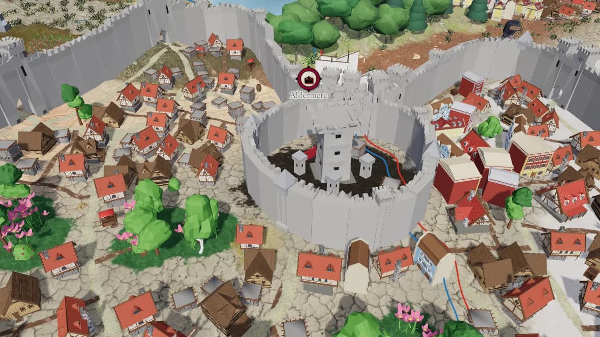
Every settlement is built in 3D from its size and setting, and you can draw its plan.
Generated towns
AvailableWalls, a keep, streets, districts, parks and houses that fit the ground; ports get a harbour and ships.
Draw the plan
AvailableDraw the wall, keep, streets and districts; everything you do not draw is generated.
Place buildings
AvailablePick building models and place them by hand, with snapping and turning.
City builder
PlannedA version of Worldkiln focused on one city, opened from a world or on its own.
More 3D models
In progressMore buildings, trees and props, made for Worldkiln.
Import your own maps
Already drawn your world? Build it from your map instead of a seed.
Drawn maps
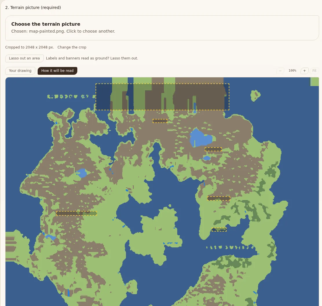
AvailableA map coloured by kind of ground: each colour is given a land group and a biome.
Illustrated maps
AvailableFinished maps with painted ground, drawn mountains and forests, a legend and fog of war.
Labels left out
AvailableBanners and scale bars are found and left out of the ground; lasso out anything else.
Settlements from the legend
AvailableSettlement pictures are found by matching the map's legend.
Reading names
PlannedReading the names written on an illustrated map.
Roadmap
What we are working on and what comes after. Order and timing can change.
More settings
PlannedFurther settings (for example medieval, steampunk and science fiction), each with its own places, models and look.
Kingdoms, settlements and roads
City builder
PlannedA version of Worldkiln focused on one city, opened from a world or on its own.
Towns in 3D
More 3D models
In progressMore buildings, trees and props, made for Worldkiln.
Towns in 3D
Reading names
PlannedReading the names written on an illustrated map.
Import your own maps
Phones and tablets
PlannedAn editor that works well on touch screens.
Saving, sharing and play
Export to 2D and 3D formats
PlannedTake your world into other tools and game engines.
Saving, sharing and play
Online play
PlannedOutputs for virtual tabletops and tabletop-friendly maps.
Saving, sharing and play